


-3.png?length=1000&name=Inpixon%20LinkedIn%20Banner%20August%202025%20(2)-3.png)
In industrial environments, accurate, real-time visibility into asset location and status is critical for safe, efficient operations. Traditional GPS, while effective outdoors, is often unreliable or unusable in factories, warehouses, mines, and other complex facilities—making dedicated industrial asset tracking solutions essential.
Modern real-time location systems (RTLS) pinpoint the live position of tools, equipment, vehicles, WIP, and other high-value assets across your site, using technologies such as Bluetooth, Wi‑Fi, UWB, and Chirp. In this post, we’ll compare the main RTLS technologies for industrial asset tracking and outline their key advantages and disadvantages to help you choose the right fit for your operations.
Types of Indoor Positioning Systems
| Technology | Accuracy | Range | Power Supply | Battery Life | Cost Range |
|---|---|---|---|---|---|
|
Chirp Spread Spectrum (CSS) |
1-2 meters* | 10-500 meters* (up to 1000 meters) | Tags powered by battery, anchors powered by Power over Ethernet (PoE) | High | Low ($) |
|
Ultra-Wideband (UWB) |
+/- 40 centimeters* | 0-50 meters* (up to 200 meters) | Tags powered by battery, anchors powered by Power over Ethernet (PoE) | High | Medium ($$) |
| Bluetooth (BLE) | up to 2 meters | up to 75 meters | Can be battery powered or connected to electrical grid | High | Low-Medium ($-$$) |
| Wi-Fi | up to 15 meters | up to 150 meters | Smartphone or battery powered | Medium | Low-Medium ($-$$) |
| Radio-Frequency ID (RFID) | up to 10 centimeters | up to 150 meters |
Passive: n/a Active: battery |
Passive: n/a Active: medium |
Medium-High ($$-$$$) |
| Inertial Measurements | 1% | up to 20 meters | n/a | n/a | Medium-High ($$-$$$) |
| Geomagnetic | up to 1 centimeter | up to 20 meters | n/a | n/a | Low-Medium ($-$$) |
* With optimal conditions and deployment
Chirp Spread Spectrum (CSS)
Chirp Spread Spectrum is a unique RF technology, useful for RTLS applications in asset tracking or two-way ranging. Chirp transmits data through radio waves using a wideband modulation technique, sending signals between devices also known as “chirps”. It’s known for its distinct advantages in range, accuracy, and reliability.
- Advantages: Chirp’s long ranging capabilities (up to 1000 meters in optimal conditions) allow for fewer anchors needed for deployments, serving as a lower cost option for RTLS. It also has in-and-outdoor capabilities without the need for a spectrum license, providing customers ease of mind regarding regulatory compliance. Its low frequency allows it to be a highly reliable technology, suitable in harsh industrial environments.
- Disadvantages: Chirp would not be the best match for RTLS use cases where precise centimeter accuracy is required.
Ultra-Wideband (UWB)
UWB is a cutting-edge RF technology that provides precise location information in an RTLS. It can transmit high data rates between devices over short ranges, and pinpoint exact location in real-time. UWB also operates with a high bandwidth over a very wide frequency spectrum.
- Advantages: UWB consumes very little power, is highly reliable and is outstanding for precise asset tracking to the nearest centimeter. Its 10-50 centimeter accuracy is useful for personnel tracking, physical asset tracking and more.
- Disadvantages: The precision that UWB offers only works over shorter ranges, and more anchors would be required in deployments to cover a longer range.
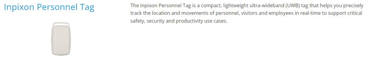
Below is a snapshot of our Inpixon Personnel Tag from our RTLS Tags page, which utilizes UWB.
Bluetooth Beacons
Beacons are tiny pieces of hardware which emit Bluetooth signals to phones. Beacons use BLE (Bluetooth Low Energy) to communicate with smartphones and let them know the distance they are away from a particular beacon. A large network of Beacons is required to provide the accuracy necessary for an IPS.
- Advantages: The accuracy of Bluetooth Beacons is thought to be very reliable and depending on the desired use case, the business can configure the Beacon network to be more or less accurate through settings and the number of beacons installed.
- Disadvantages: There is a substantial upfront hardware and installation cost associated with Bluetooth Beacons. Also, depending on the venue and their IT protocols, increased BLE network traffic may not be preferred.
Wi-Fi Networks
Wi-Fi networks can be used to identify a user's general location. Similar to Beacons, the strength of the Wi-Fi signal is used to determine the distance a user is from a particular access point.
- Advantages: Existing Wi-Fi networks, including private networks can be used. The user does not need to connect to a network to determine their location. Their location is determined by the strength of the signal being received by the closest access point.
- Disadvantages: Accuracy will vary depending on the number of access points installed. Most spaces do not have enough Wi-Fi access points installed to provide an accurate indoor positioning experience and prolonged latency time can increase the deviation of the user’s actual location.
Radio Frequency Identification (RFID)
RFID transponder tags contain an integrated circuit and antenna which are used to transmit data to a reader. The reader then converts the radio waves to a more usable form of data. In most cases, the tags are passive and have no individual power supply. Depending on the frequency range, the reader must be located within a radius of between a few inches to one yard from the RFID tag to be able to transmit data. Active RFID tags have their own individual battery, making them more expensive and heavier, however, they have a significantly higher range of up to 10 meters.
- Advantages: RFID can be helpful for simple use cases, and is often employed by the production and logistics sectors for asset tracking through production processes. RFID also allows for data, like expiration dates, to be saved to an object's attached RFID tag, which can be especially helpful for hospital and medication logistics.
- Disadvantages: It does not allow automatic indoor positioning. Instead, you must set predefined points with RFID readers which are triggered when the tagged object passes.
So, What is the Best Type of IPS for Your Organization?
Given the pros and cons of each of the Indoor Positioning System options, the decision of which technology to rely on will largely depend on various factors unique to your venue and your goals, and what use cases you'd like to implement. Once a venue has invested in indoor positioning technologies, the possibilities extend to asset tracking, business intelligence, proximity messaging, and more.
Let our experienced team of solution engineers and map experts help you identify and solve your spatial challenges - talk to us today.
Updated March 29th 2022 This post was originally published on July 9, 2020 and has been updated to include emerging technologies and new information.